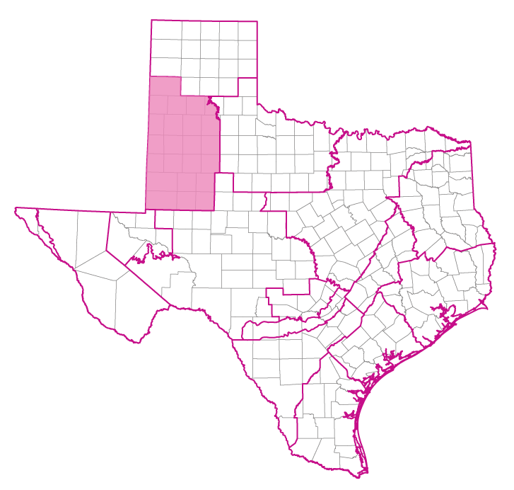
Groundwater Management Area 2
Groundwater Management Area 2 Webpage
Contact Information
High Plains Underground Water Conservation District No. 1
Jason Coleman
General Manager
2930 Avenue Q
Lubbock, Texas 79411
Telephone: (806) 762-0181
Fax: (806) 762-1834
Email: jason.coleman@hpwd.org
Regional Water Planning Group Representatives:
Region F: Raymond Straub
Region O: Ronnie Hopper
2021 Joint Planning Desired future conditions and modeled available groundwater
Summary of Desired Future Conditions for GMA 2
Summary of Modeled Available Groundwater for GMA 2 by Groundwater Conservation District
Summary of Modeled Available Groundwater for GMA 2 by County
Groundwater Conservation Districts (7 either partially or completely included)
- Garza County Underground Water Conservation District
- High Plains Underground Water Conservation District No. 1
- Llano Estacado Underground Water Conservation District
- Mesa Underground Water Conservation District
- Permian Basin Underground Water Conservation District
- Sandy Land Underground Water Conservation District
- South Plains Underground Water Conservation District
Additional Groundwater Conservation District Information
Exempt Groundwater Use Estimates
Aquifers(either partially or completely included)
Major Aquifers
Minor Aquifers
Component Counties
GMA 2 Reports
| ID | Date | Type | Description |
|---|---|---|---|
| GR16-028_MAG | 5/16/2017 | GAM run - MAG | Modeled available groundwater for the aquifers in Groundwater Management Area 2 |
| R-111 | 3/11/1970 | TWDB numbered report | An Investigation of Clouds and Precipitation for the Texas High Plains |
| R-288 | 5/1/1984 | TWDB numbered report | Evaluating the Ground-Water Resources of the High Plains of Texas, Volumes 1-4 |
| R-341 | 9/1/1993 | TWDB numbered report | The High Plains Aquifer System of Texas, 1980 to 1990 - Overview and Projections |
| R-355 | 1/1/2003 | TWDB numbered report | Evaluation of Enhanced Recharge Potential to the Ogallala Aquifer in the Brazos River Basin, Hale County, Texas |
| R-357 | 8/1/2003 | TWDB numbered report | Characterization of Playa Basins on the High Plains of Texas |
| R-359 | 12/1/2003 | TWDB numbered report | The Groundwater Resources of the Dockum Aquifer in Texas |
| HA-10 | 1/1/1998 | Hydrologic atlas | Updated Water-Quality Evaluation of the Ogallala Aquifer, Including Selected Metallic and Non-Metallic Inorganic Constituents |
| R-010 | 12/1/1965 | TWDB numbered report | Studies of Playa Lakes in the High Plains of Texas |
| B-6010 | 11/1/1960 | Groundwater bulletin | Geology and Ground-Water Resources of Hale County, Texas |
| R-015 | 2/1/1966 | TWDB numbered report | Ground-Water Resources of Gaines County, Texas |
| GMA2_DFC_01 | 8/5/2010 | DFC submission | Desired future conditions for the Ogallala, Dockum, and Edwards-Trinity (High Plains) aquifers |
| R-314 | 3/1/1989 | TWDB numbered report | Hydrogeology of Lower Cretaceous Strata Under the Southern High Plains of Texas and New Mexico |
| B-6310 | 12/1/1973 | Groundwater bulletin | Reconnaissance Investigation of the Ground-Water Resources of the Brazos River Basin, Texas |
| R-235 | 7/1/1979 | TWDB numbered report | Occurrence, Availability, and Chemical Quality of Ground Water in the Edwards Plateau Region of Texas |
| R-337 | 3/1/1992 | TWDB numbered report | Evaluation of Water Resources in Parts of the Rolling Prairies Region of North-Central Texas |
| R-342 | 8/1/1993 | TWDB numbered report | Water-Quality Evaluation of the Ogallala Aquifer, Texas |
| R-313 | 2/1/1989 | TWDB numbered report | Evaluation of Ground-Water Resources in Briscoe, Hale, and Swisher Counties, Texas |
| R-330 | 7/1/1991 | TWDB numbered report | Evaluation of Ground-Water Resources in the Southern High Plains of Texas |
| R-071 | 3/1/1968 | TWDB numbered report | Reconnaissance of the Chemical Quality of the Surface Waters of the Colorado River Basin, Texas |
| R-167 | 4/1/1973 | TWDB numbered report | Ground-Water Resources of Hall and Eastern Briscoe Counties, Texas |
| HA-01 | 1/1/1991 | Hydrologic atlas | Water-Level Changes in the High Plains Aquifer of Texas, 1980-1990 |
| GR11-009_MP | 6/24/2011 | GAM run - Management Plan | Management plan information for High Plains UWCD No. 1 |
| GT11-010 | 6/14/2011 | GAM task | Total pumping estimates for the Ogallala, Edwards-Trinity (High Plains), and Dockum aquifers in High Plains UWCD No. 1 |
| GT10-025 | 6/10/2010 | GAM task | Predictive simulations for the Dockum Aquifer |
| GR09-023 | 5/21/2010 | GAM run | Predictive simulation for the Ogallala and Edwards-Trinity (High Plains) aquifers in Groundwater Management Area 2 |
| GR09-018_MP | 7/24/2009 | GAM run - Management Plan | Management plan information for Llano Estacado UWCD |
| GR09-007_MP | 3/17/2009 | GAM run - Management Plan | Management plan information for Garza County UWCD |
| GR09-006_MP | 3/17/2009 | GAM run - Management Plan | Management plan information for High Plains UWCD No. 1 |
| GR09-005_MP | 3/17/2009 | GAM run - Management Plan | Management plan information for Sandy Land UWCD |
| GR09-003_MP | 1/23/2009 | GAM run - Management Plan | Management plan information for High Plains UWCD No. 1 |
| GR09-002_MP | 1/23/2009 | GAM run - Management Plan | Management plan information for Garza County UWCD |
| GR08-085 | 4/23/2009 | GAM run | Predictive simulations for the Ogallala Aquifer in Groundwater Management Area2 |
| GR08-085_Add | 5/21/2010 | GAM run | Initial and final water volumes for the simulations presented in GAM Run 08-085 |
| GR08-063_MP | 9/24/2008 | GAM run - Management Plan | Management plan information for High Plains UWCD No. 1 |
| GR08-061 | 11/21/2008 | GAM run | Predictive simulation for the Ogallala Aquifer in Groundwater Management Area 2 |
| GR08-055_MP | 8/1/2008 | GAM run - Management Plan | Management plan information for Garza County Underground and FWCD |
| GR08-047_MP | 6/27/2008 | GAM run - Management Plan | Management plan information for Sandy Land UWCD |
| GR08-046_MP | 8/1/2008 | GAM run - Management Plan | Management plan information for Mesa UWCD |
| GR08-033_MP | 5/28/2008 | GAM run - Management Plan | Management plan information for Permian Basin UWCD |
| GR08-018_MP | 5/30/2008 | GAM run - Management Plan | Management plan information for South Plains UWCD |
| GR07-044_Rev1 | 2/25/2008 | GAM run | Predictive simulations for the Ogallala Aquifer in Groundwater Management Area 2 |
| GR04-012 | 10/1/2004 | GAM run | Hydraulic conductivity data for the Ogallala Aquifer GAMs |
| GR04-007 | 7/27/2004 | GAM run | Volumetric calculations for all counties in Llano Estacado Regional Water Planning Group |
| GR04-005 | 5/10/2004 | GAM run | Groundwater volume in each county-basin zone of Region O (Llano Estacado) |
| GR03-036 | 3/16/2004 | GAM run | Predictive run with Region O provided increase in irrigation pumping |
| GR03-035 | 6/23/2004 | GAM run | Water table declines and water budget in South Plains UWCD |
| GR04-005_CM | 6/1/2004 | GAM run | Groundwater volume in each county-basin zone of Region O (Llano Estacado) − Clarification memo |
| GR03-023 | 8/22/2003 | GAM run | Water budget and total available storage for the Ogallala Aquifer in Permian Basin UWCD |
| GR03-022 | 3/9/2004 | GAM run | Volume of water in storage and recharge information for the Ogallala Aquifer in High Plains UWCD No. 1 |
| GR03-021 | 11/3/2003 | GAM run | Water table decline maps for the Ogallala Aquifer in South Plains UWCD |
| GR03-020 | 8/22/2003 | GAM run | Water budget and total available storage for the Ogallala Aquifer in Garza County UFWCD |
| GR03-010 | 6/20/2003 | GAM run | Water budget and total available storage for the Ogallala Aquifer in Mesa UWCD |
| GR03-009 | 7/21/2003 | GAM run | Terry county water budget for the Ogallala Aquifer |
| GT10-023 | 6/8/2010 | GAM task | Predictive simulations for the Ogallala and Edwards-Trinity (High Plains) aquifers in Groundwater Management Area 2 |
| GR12-006_MP | 4/11/2012 | GAM run - Management Plan | Management plan information for South Plains UWCD |
| GR12-007_MP | 6/13/2012 | GAM run - Management Plan | Permian Basin UWCD Management Plan |
| GR12-008_MP | 6/20/2012 | GAM run - Management Plan | Management plan data for Mesa UWCD |
| GR10-030_MAG | 6/22/2011 | GAM run - MAG | Managed available groundwater for the Ogallala and Edwards-Trinity (High Plains) aquifers in Groundwater Management Area 2 |
| GR10-035_MAG_Ver3 | 7/9/2012 | GAM run - MAG | Modeled available groundwater for the Dockum Aquifer in Groundwater Management Area 2 |
| GR13-017_MP | 8/7/2013 | GAM run - Management Plan | Management plan data for Mesquite GCD |
| GR13-022_MP | 8/28/2013 | GAM run - Management Plan | Management plan data for Sandy Land UWCD |
| GR13-021_MP | 8/28/2013 | GAM run - Management Plan | Management plan data for Garza County UWCD |
| GT13-026_TERS | 9/19/2013 | GAM task - Total Estimated Recoverable Storage | Total Estimated Recoverable Storage for aquifers in Groundwater Management Area 2 |
| GT13-042_TERS | 11/1/2013 | GAM task - Total Estimated Recoverable Storage | Total Estimated Recoverable Storage by county for aquifers in High Plains UWCD No. 1 |
| GR14-002_MP | 6/30/2014 | GAM run - Management Plan | Management plan data for Llano Estacado UWCD |
| GR16-013_MP | 8/31/2016 | GAM run - Management Plan | Management plan information for Permian Basin UWCD |
| GR18-004_MP | 3/29/2018 | GAM run - Management Plan | Management plan information for South Plains UWCD |
| GR18-009_MP | 5/25/2018 | GAM run - Management Plan | Management plan information for Mesa UWCD |
| GR18-014_MP | 1/15/2019 | GAM run - Management Plan | Management plan information for Sandy Land UWCD |
| GR19-002_MP | 3/1/2019 | GAM run - Management Plan | Management plan information for High Plains UWCD #1 |
| GR19-001_MP | 5/3/2019 | GAM run - Management Plan | Management plan information for Garza County UWCD |
| GR19-017_MP | 7/22/2019 | GAM run - Management Plan | Management plan information for Llano Estacado UWCD |
| GR21-008_MAG_Add | 6/3/2022 | GAM run - MAG | Modeled Available Groundwater for the aquifers in Groundwater Management Area 2 |
| GR22-005_MP | 5/23/2022 | GAM run - Management Plan | Management plan information for Permian Basin UWCD |
| GR23-007_MP | 5/1/2023 | GAM run - Management Plan | Management plan information for South Plains UWCD |
| GR23-022_MP | 09/19/2023 | GAM run - Management Plan | Management plan information for Mesa UWCD |
| GR23-024_MP | 12/14/2023 | GAM run - Management Plan | Management plan information for Sandy Land Underground Water Conservation District |
| GR24-004_MP | 03/14/2024 | GAM run - Management Plan | Management plan information for Garza County UWCD |