Report 124 by G.H. Shafer U.S. Geological Survey | December 1970
- Report 124 - Ground-Water Resources of Aransas County, Texas
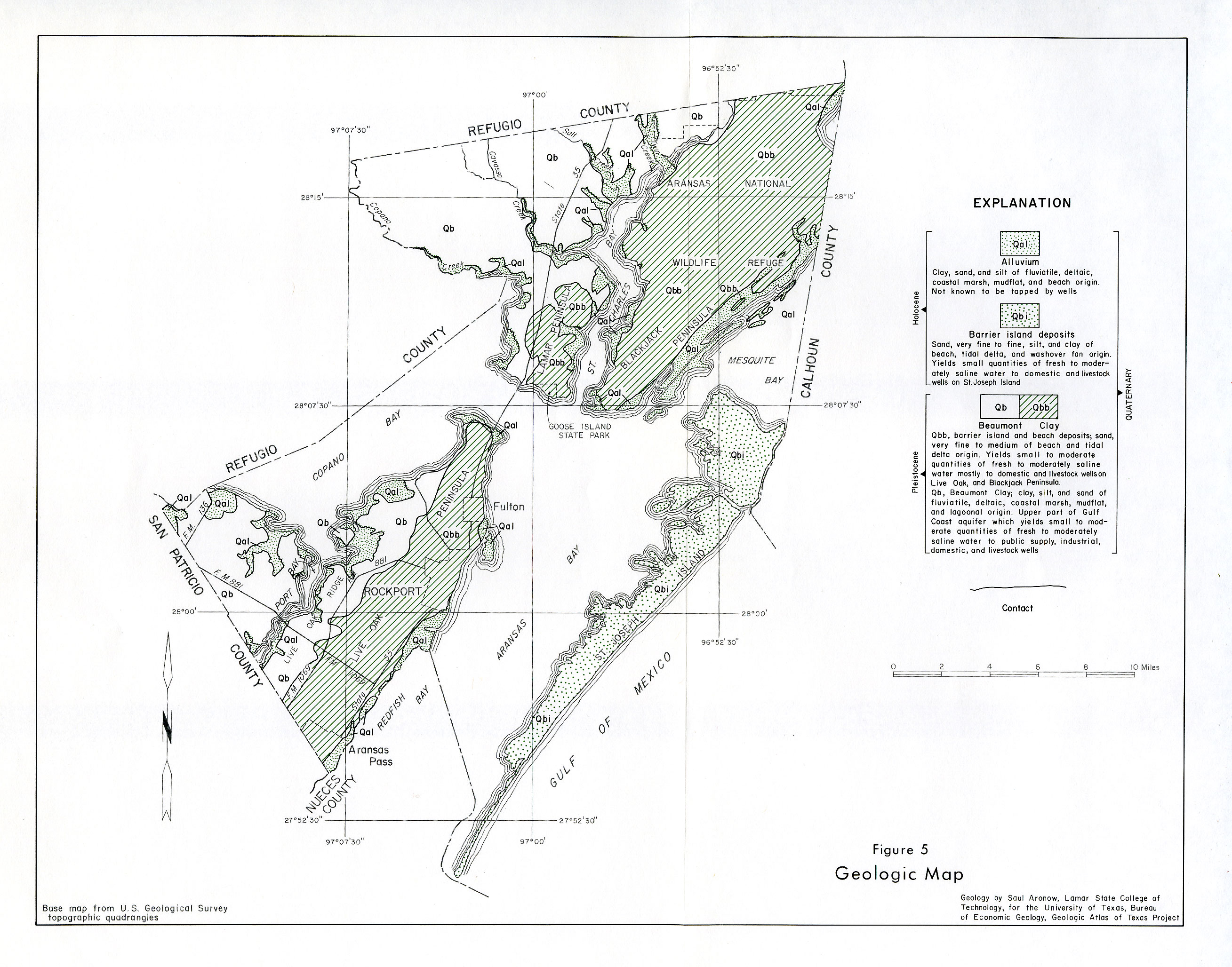
- figure 5 - Geologic Map
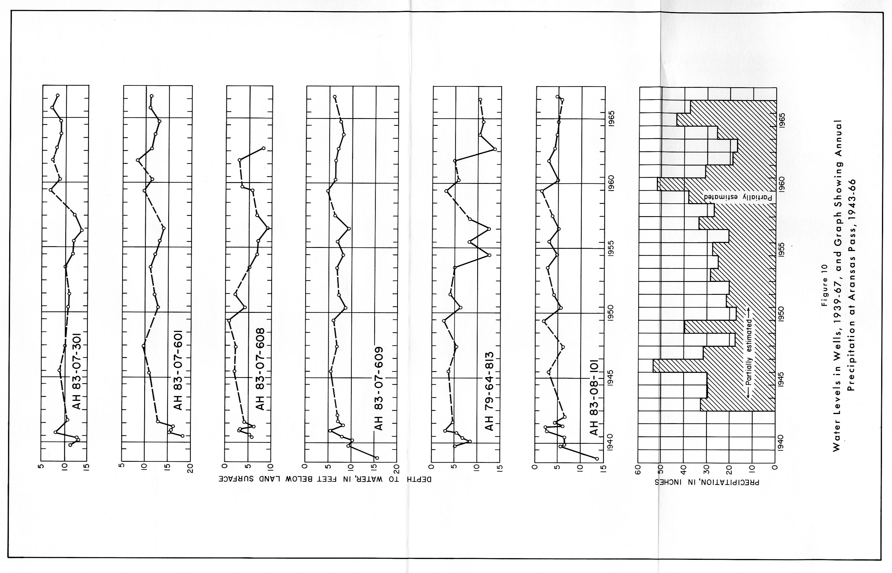
- figure 10 - Water levels in Wells, 1939-67, and Graph Showing Annual Precipitation at Aransas Pass, 1943-66
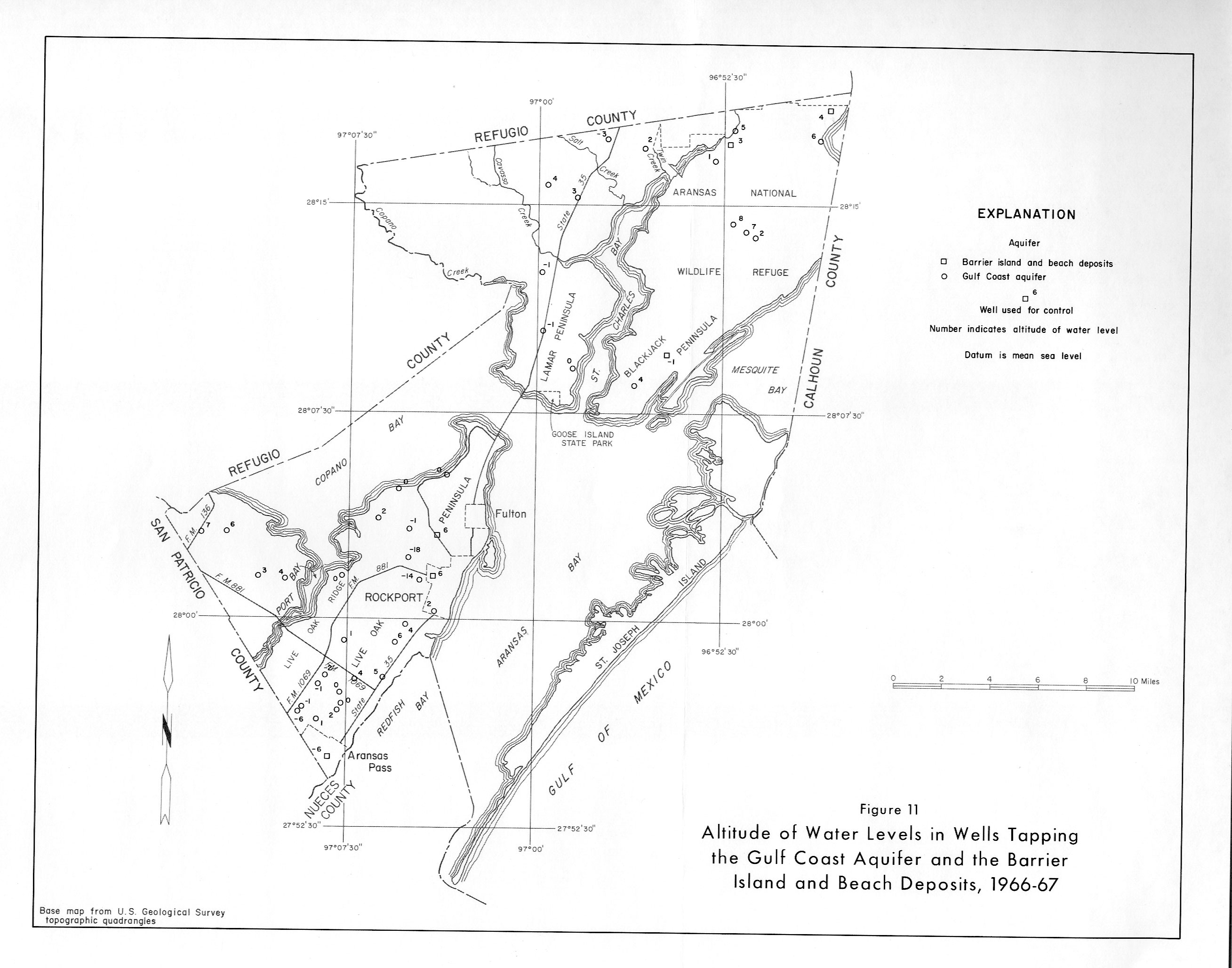
- figure 11 - Altitude of Water Levels in Wells Tapping the Gulf Coast Aquifer and the Barrier Island and Beach deposits, 1966, 67
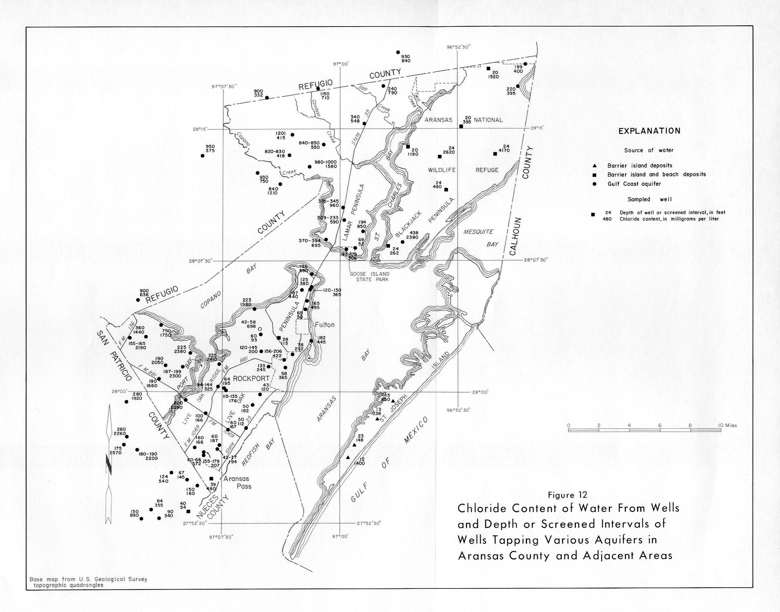
- figure 12 - Chloride Content of Water From Wells and Depth or Screened Intervals of Wells Tapping Various Aquifers in Aransas County and Adjacent Areas
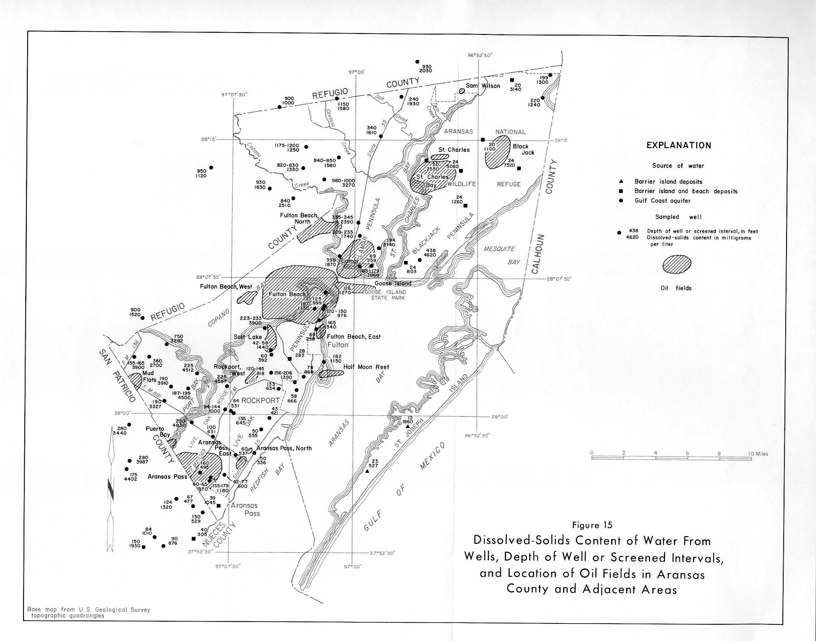
- figure 15 - Dissolved-Solids Content of Water From Wells, Depth of Well or Screened Intervals, and Location of Oil Fields in Aransas County and Adjacent Areas
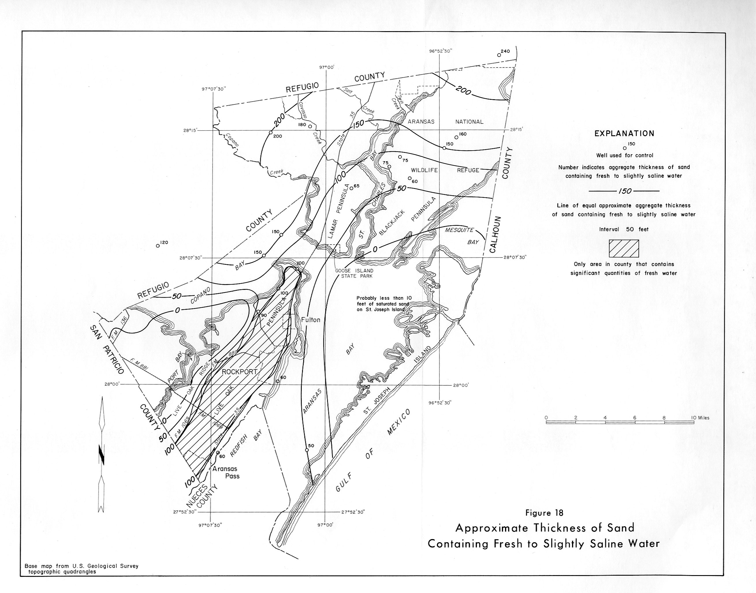
- figure 18 - Aproximate Thickness of Sand Containing Fresh to Slightly Saline Water
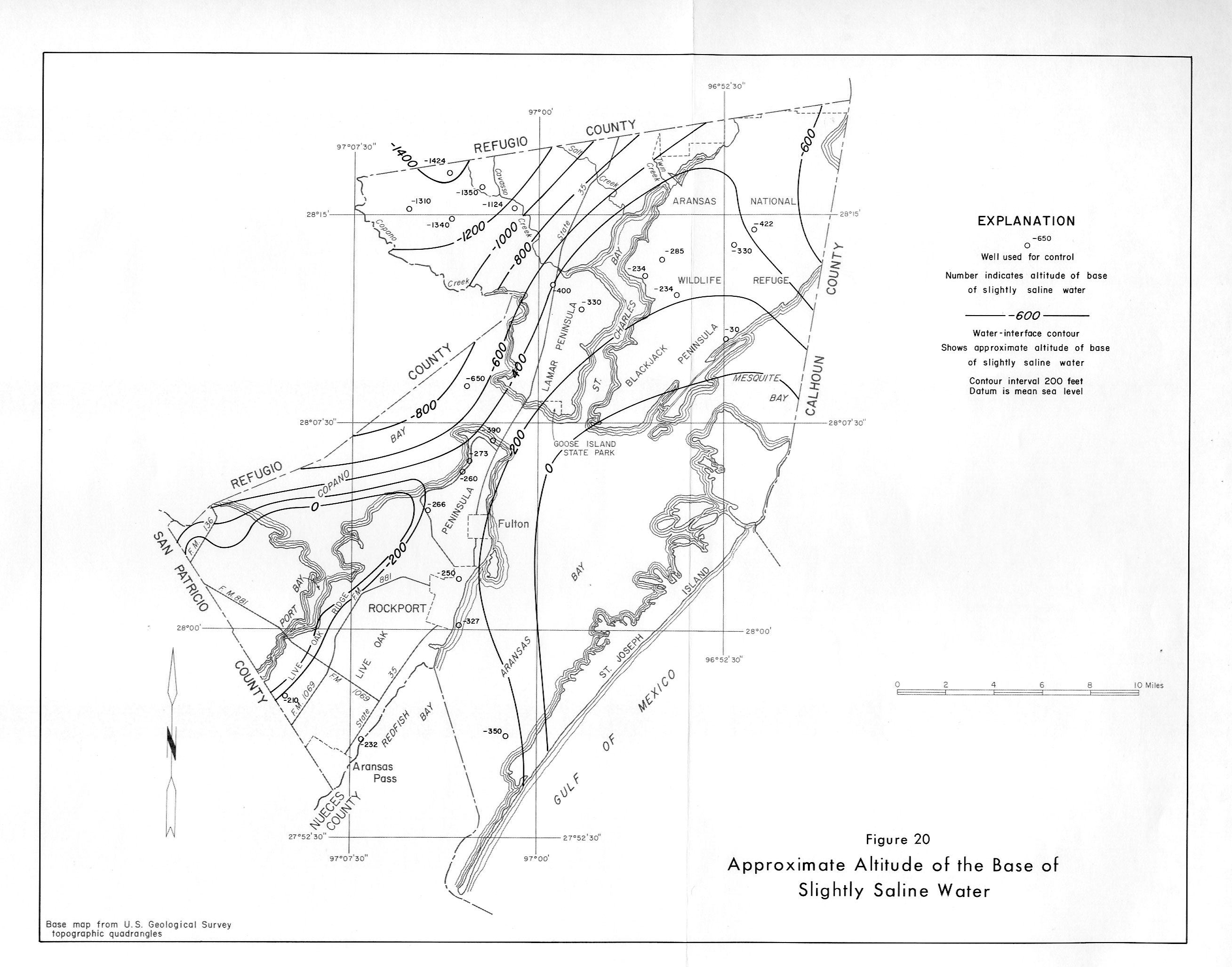
- figure 20 - Approximate Altitude of the Base of Slightly Saline Water
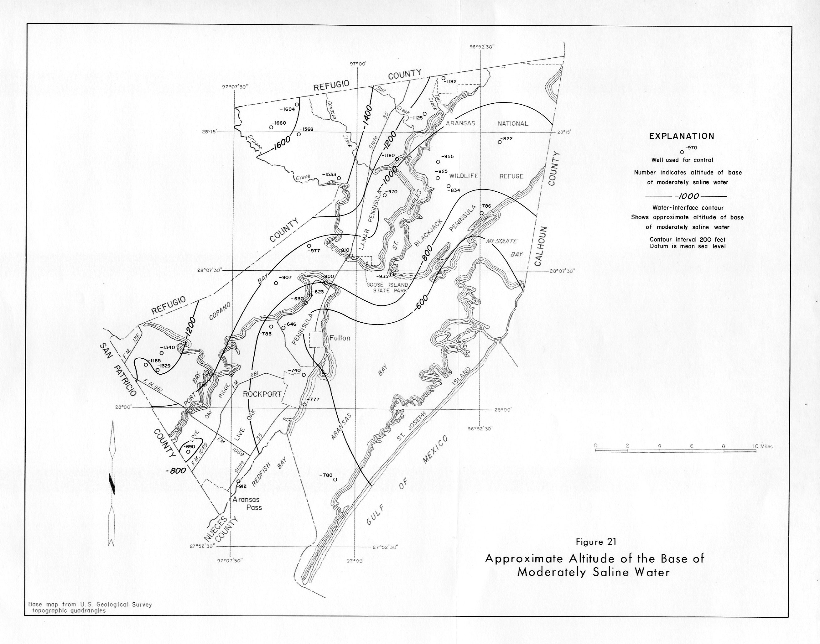
- figure 21 - Approximate Altitude of the Base of Moderately Saline Water
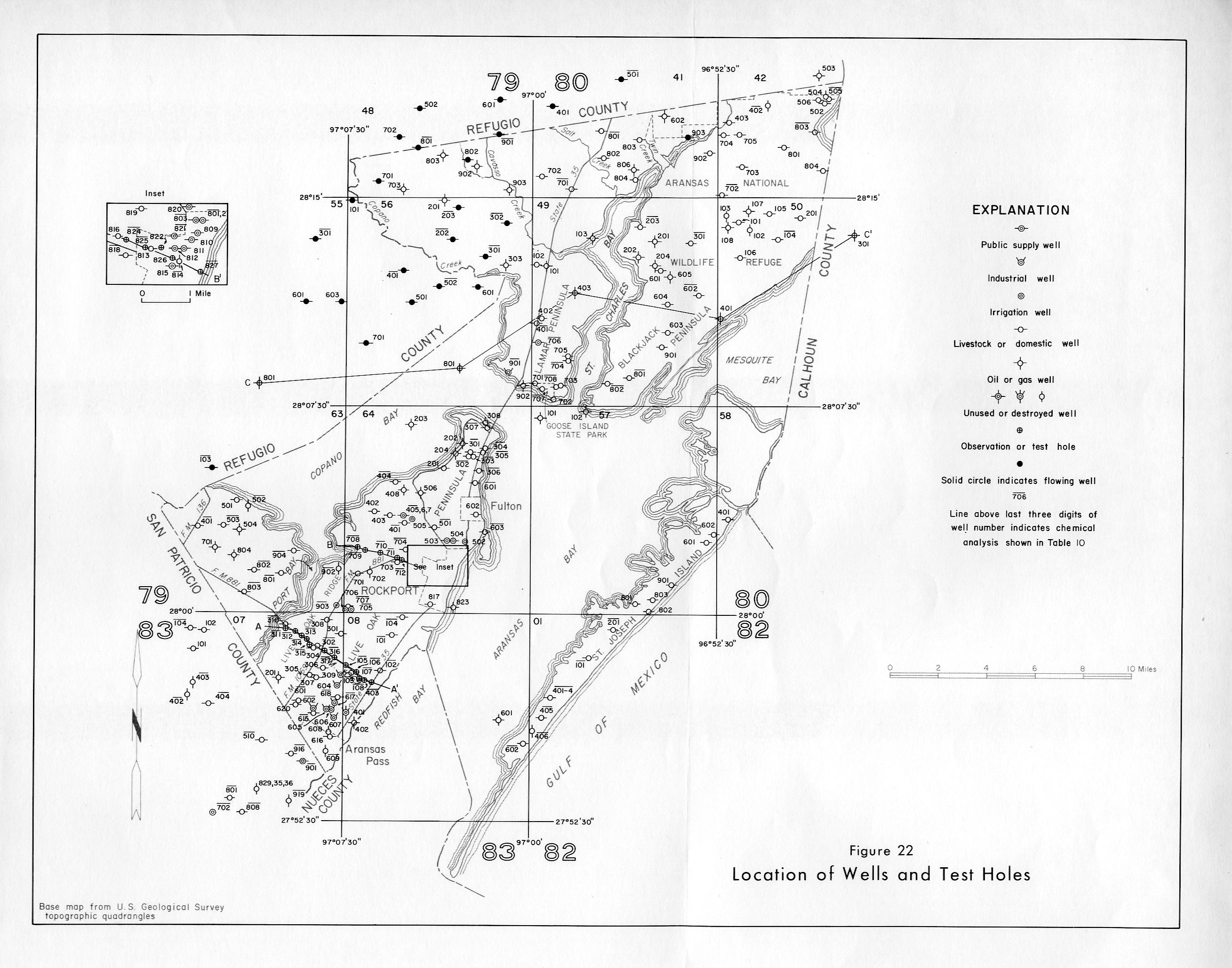
- figure 22 - Location of Wells and Test Holes